In July 2022, a team from University of the Philippines, including myself and Prof. Grace Barretto-Tesoro undertook palaeoenvironmental fieldwork in the island of Luzon as part of the PANTROPOCENE Project– an ERC-funded project bringing together researchers from the Philippines, Europe, Hong Kong, the USA and Australia and headed up by Dr. Patrick Roberts out of the Max Planck Institute for Geoanthropology. The fieldwork entailed coring Lake Baao in the province of Camarines Sur as part of the project’s multicomponent research strategy to use paleoenvironmental data alongside historical and archaeological research to reveal past land use patterns during- and prior to- Spanish colonization in 1565 CE.
The Bicol region, which hosts Lake Baao, is crucial for understanding the environmental impacts of tropical colonization at a local and global scale. The regional geography of the area – which supported deep, sheltered harbours and dense hardwood forests – was ideal for the ship construction, and served as the backbone for the construction of Manila Galleons. These ships were responsible for trade between Asia and the Americas, and instrumental to the so-called ‘Columbian Exchanges’ – transporting crops, cultures, and disease between the Pacific and Atlantic.
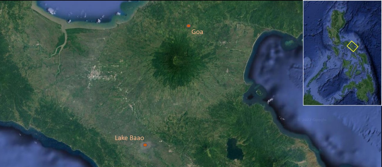
Lake Baao (Fig. 1), is small (<2 km2), shallow (<1m deep) freshwater lake fed by small streams and runoff. These attributes, and well as its location, made it an ideal, relatively easy first coring site for the project. We were aiming to capture a time depth of about 2,000 years BP at a high resolution to assess human-environment interactions before- and after- the Spanish period in the Philippines.
Meeting the team and scoping the lake
Grace and I met up with Dr. Stephen Acabado of the UCLA-Cotsen Institute of Archaeology, and also a collaborator of the project, at Partido State University (PSU) in the town of Goa. Stephen was running a field school with graduate and undergraduate students mainly from UCLA, University of Washington, PSU, and other American universities. The program, part of the Bicol Archaeological Project (BAP), teaches archaeological theory and methods such as systematic excavation, remote sensing survey as well as ceramic, faunal, and human osteological analyses. The group was also joined by international participants from Thailand, Indonesia, Singapore, and China.
A member of the BAP team, Earl Hernandez, curator at the Museo de Isarog and now a PhD student at UCLA, acted as a liaison for us during our time in Camarines Sur. Earl set up our visit to the Baao Municipal Hall for a courtesy call to the town’s mayor. This is a necessary step every time we start archaeological research in the Philippines. Prior to this, Earl requested a permit from the national government through the National Commission of Culture and the Arts (NCCA). When we visit municipal offices or barangay halls, our intention is to inform local officials of our project and what we will be doing in their communities. A benefit of undertaking this step is that local government officials are often very receptive and frequently offer help as well. For the Baao case, the mayor was not able to meet with us due to prior engagements; however, we were welcomed and assisted by two representatives of the municipal office. They also facilitated finding a guide to help us collect cores from the lake.
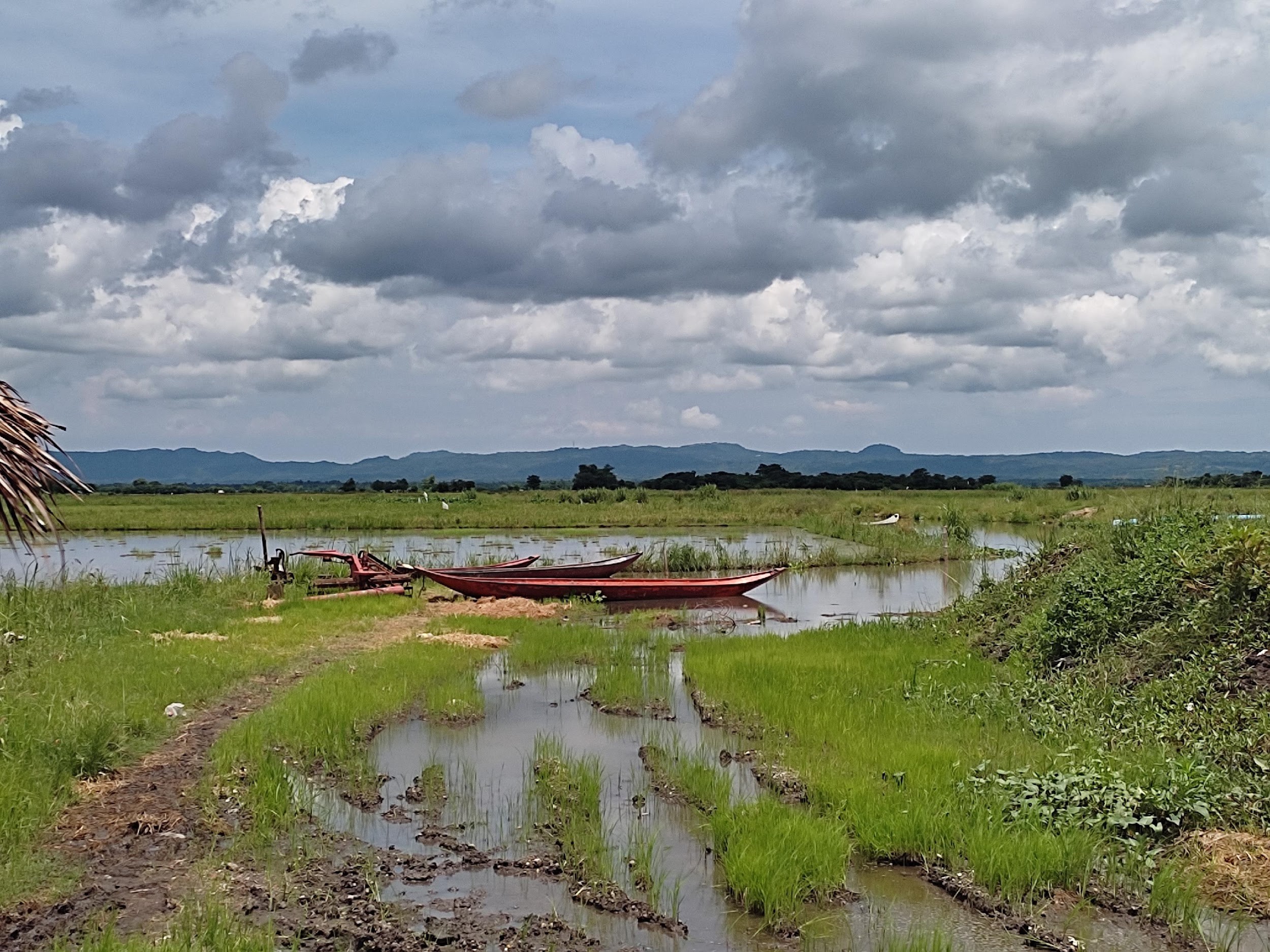
Manoy (older brother in the Bicolano language) Junel used to work for the Fisheries Department and has intensive knowledge of the lakes in Baao. We learned from Manoy Junel, and also saw firsthand, that the lake is not easily accessible. From the highway, we had to walk for about one hour on a dirt road that was in the early stages of being paved. Running parallel to this dirt road is a tributary that leads to Lake Baao in one direction, and to rice fields in the other. The dirt road was incredibly muddy and slippery; activities from heavy construction machinery and runoff from the surrounding tributaries made for a slow trek through long stretches of mud. From the end of the dirt road (Fig. 2), we would need to take a canoe to the lake – a trip of one and a half hours. Manoy Junel agreed to supply the boat for us to use for our coring activity. He also introduced us to Manoy Rodolfo, another local boatman, who with his son-in-law, Melo, also helped to ferry us to our study site.
Aside from Grace and I, the coring team included geologists from PSU, Cristina “Tina” Faurillo Viloria and Angelika Sadsad. Tina invited her husband Lanze Viloria, another geologist, to help us. Tina and Angie easily identified the different sediment matrices and other components in our core samples. They worked together in completing the coring log. She participated in the sample collection activity in Lake Lanao in Cebu a few months earlier. The Lake Lanao palaeoenvironmental coring was also done as a collaboration between the PANTROPOCENE and the University of San Carlos (USC) in Cebu. Led by Drs. John Peterson and Jojo Bersales, Tina along with USC grad students Yano Rios and Gavin Cubillo gained experience using a Russian D-section corer. Because of this, Tina was elected to be the leader of the Baao group as she has the most experience using a D-section corer. In 2023, as part of the collaboration, Dr. Peterson will join us to collect more samples from Laguna Lake where we will be using his Bolivia-type piston corer.
Coring Baao
We met up with Manoy Junel, Manoy Rodolfo, and Melo early the next day, and loaded our gear into the canoe. It was a slim canoe, only able to accommodate passengers in a single file (Fig. 3). When I arranged the use of a boat the previous day, I was assured that the canoe could carry ten people including two boatmen as they use this to transport 20 sacks of rice! This gave us the impression that we would be able to move freely onboard, but we were mistaken. I was not able to sufficiently explain to them what our activity would entail us to do onboard the canoe. Because of the size dimensions of the canoe, movement onboard was very restrictive. We set off nonetheless to Lake Baao, amid rice fields and lots of trepidation.
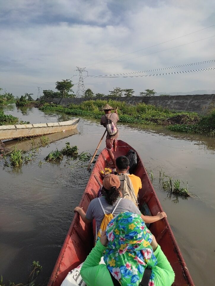
Along the way, I finally understood what the municipal representatives were referring to when we made our courtesy visit. During our visit, they kept mentioning that floodwaters from the town flow into Lake Baao. Around half an hour into our trip, we came upon a section that is littered with trash. It seems litter is concentrated there caught by water hyacinths that have proliferated within the tributary. The water hyacinths were also making our progress through the waterway slow as the canoe could not pass through freely.
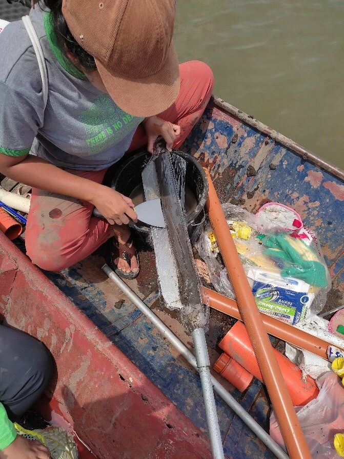
We finally located our coring site near the center of Lake Baao, following recommendation made by the palaeoecologists at Australian National University (ANU) and MPI-GA. This follows the assumption that the deepest point in the lake is near the centre which gives us the highest probability of sampling a continuous, undisturbed depositional record. At this location in the lake, we plotted our first core sample, BAAO Split 1. We first tried using a guide tube to mark our hole. The guide tube would make it easy for us to locate the hole after we pull the corer to collect the sample. However, we soon realized the inner diameter of the tube was too tight to easily fit the D-section corer head. Manoy Rodolfo and Melo jumped into the water and helped us pull the guide tube out. Rather than using a guide tube, we resorted to using, what I would call, a “marker tube.” This was Tina’s idea. The idea was to place a tube to mark the spot where the hole is when we pull out the corer after each drive. Both Manoy Rodolfo and Melo would take turns placing the “marker tube” into the hole as well as pull the tube out as they guide the corer head back into the hole during the next drive. This became our routine, and they stayed in the water for the duration of our coring. It was tough going—the first 80 cm was of clayey silt, compact and wet. And while the next 20 cm graded from clay to medium-grained sand to clay, we still found the sediment to be so compact that we terminated our first core sample at a depth of 100 cm. Being the “most seasoned” member of the team in core sample collection, it was decided the day before that Tina would be the one extracting, packing, and labeling the samples (Fig. 4).
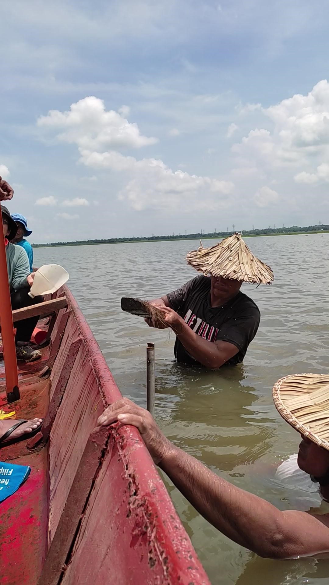
We plotted a second core (BAAO Split 2) site just a few metres beside our first core, but had to abandon it after there was spillage when we were packing the sample from our first drive. The sediment has the same features as the 0-50 cm depth sample from BAAO Split 1. We located our third core (BAAO Split 3) along the same line as the first two. This time around, the first 133 cm were of compact clay. We still found it hard going, but we wanted to go deeper than we did for our first core sample. We continued the practice we started with BAAO Split 1. When we felt that we were not getting deeper in each drive, either Melo, Manoy Rodolfo, Lanze, or I would hammer the extension rod either with a rubber mallet (which broke off quite easily) or a plank of wood that doubled as a bench onboard the canoe (Fig. 5). We eventually reached a depth of 250 cm with medium- to fine-grained sand alternating with clay particles. We also took a grab sample from the surface sediments for Rebecca Hamilton and the palaeoecology team, who will be leading the analysis of pollen and other environmental proxies from the cores, to use as a “modern” sample for the cores.
We all felt we accomplished a great deal at the end of the activity. Personally, the experience has given me more confidence for the next core sample collection. Will it be in Sorsogon, the area famous for Spanish-era shipbuilding or one of the dry maar lakes in Laguna near the capital of Manila? No matter. I think I know what to expect now.
